 |
|
HOME | The Pilots | The
Plane | Pre-Flight | Itinerary | Latest | Flight
Following
| Discussion | Newsletter | Email
![]() Join
the Ponceby Newsletter Email list for
news about the next flight
Join
the Ponceby Newsletter Email list for
news about the next flight
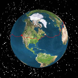
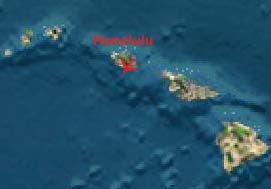
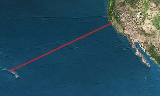
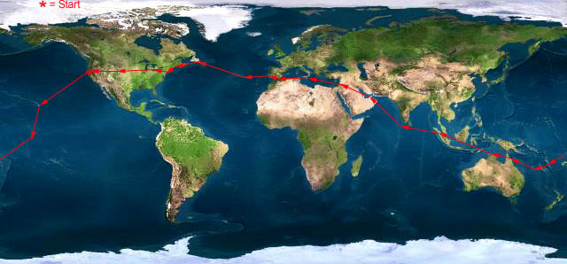
Hawaii to Kiribati California to Hawaii Departure
 |
 |
 |
 Live Satelite Image Live Satelite Image |
Satellite data provided by The Living Earth ® Inc./Earth Imaging © 1996, All Rights Reserved. | |
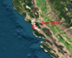
Leg 1: San Jose, CA to Honolulu, HI KSJC-PHNL 21 July 1998 2104 NM 9:00 Flight Time
.
"Calling San Francisco Radio on the HF."Preliminary Flight Planning predicted a ten hour flight. Favorable winds and higher power settings shaved an hour off the trip. Easterly trade winds were not forecast until 140 West and then with a maximum intensity of only 15 Knots. We observed easterly winds by 125 West, and by 135 West, the intensity was over 20 knots. This strong tailwind was providing such a large fuel reserve at Honolulu that we elected to run higher than max range cruise power settings to shorten the trip even further. We landed at PHNL with 1239 pounds remaining (enough to fly for an additional 3 hours, more than 600 NM). Takeoff fuel was 5447 lb.
We departed San Jose at a gross weight of 12,800 pound, 27 percent above the normal max gross of 10,100 pounds (Should we apply for type ratings?). As expected, the aircraft needed lots of nose down trim and exhibited relaxed pitch stability. Extrapolated POH data predicted an initial rate of climb of 1400 fpm. We observed a stabilized 1500 fpm, and climbed directly to FL 180 at normal climb power with a rate of 500 fpm at the top of climb. We were pleased with this performance since we had never flown the aircraft so heavy.
The entire cruise portion of the flight was flown at FL 180 rather than a normally more fuel efficient level in the mid twenties due to stronger easterly tailwinds in the lower levels (normal in the tropics).
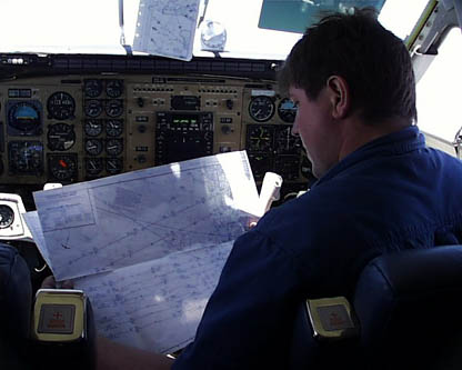
"John backing up the GPS by plotting our fixes on the Pacific en-route charts."Only two anomalies. First, the right engine oil pressure fluctuated early in the flight. We had seen this before, and it appears to be an intermittent indication problem. In any case, movement of the power lever steadied the needle. Second, midway through the flight, some fuel began sheeting from the left wing inboard trailing edge. This fuel seemed to be venting from the (full) left main tank. Changing from aux to main fuel for an hour stopped the venting, and subsequent refueling showed that we had lost no significant fuel. We have changed our tank scheduling procedure to compensate for this problem. Stay tuned.
"On the right downwind for landing Runway 4R at Honolulu."
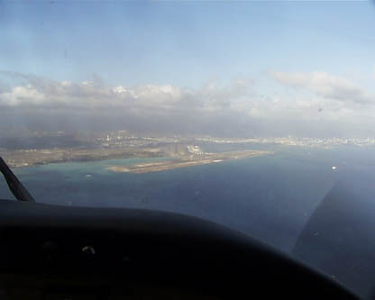
"On final approach to Runway 4R at Honolulu."
After so many delays, and so much uncertainty about whether or not we would ever be able to make the flight, it was an enormous relief finally to take off Tuesday morning and head out for Hawaii—our longest leg and purportedly the longest leg in the world with no possibility of any intermediate (dry) stop. Everyone says—and we fully concur—that the planning is the longest and hardest part of the trip. The flying is always great, and we were delighted to get on with that part of the trip. We started having fun again…
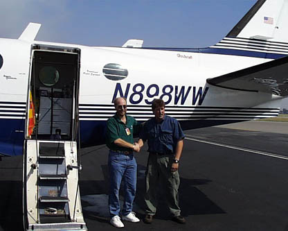
"Minutes before launching on the leg to Hawaii from San Jose."
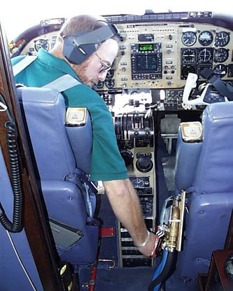
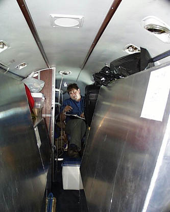
"Doug working ferry fuel transfer valves en-route to Honolulu."The plane flew beautifully, and the long trip passed quickly. Between having to pump ferry fuel every 25 minutes or so, for 10 to 15 minutes at a time; making our HF radio reports and replying to relayed requests for revised ETAs from our handlers in Honolulu; to eating our two meals, and changing many CDs to keep appropriate tunes going, we had lots to do. Even with most of the interior removed, we still had the lavatory seat (plushly upholstered) in the rear, which made a nice place to go back and rest and put your feet up on the cooler. Just being able to get up and walk around made the trip much more comfortable than traveling in the Bonanza.
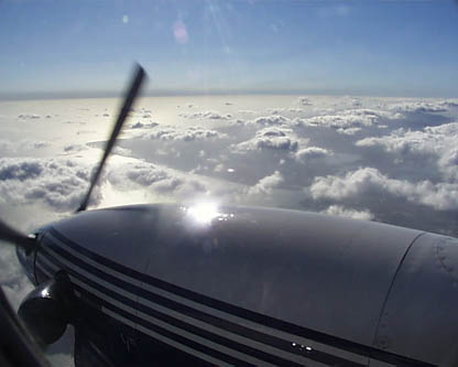
"John resting on the lav seat in the rear of the plane on the way to Honolulu."Even though there was looks of talk between other planes and San Francisco radio on the HF, much more than we had heard over the North Atlantic in previous crossings, we never saw another plane or even the contrails of a high-flying jet. It was a real thrill to catch our first glimpse of land ("feet dry") after over eight hours of flying, spotting it first on the radar and then getting a visual. The landing was an easy visual approach, with wind 21 knots right down the runway, and was a good finish to our first trans-Pacific crossing.
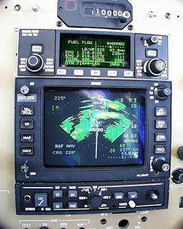
"Our first electronic sight of land on the radar."That night over dinner, we realized we were too tired to do all the necessary flight planning and Web-site feeding before sleep, so we decided to spend an extra day in Honolulu figuring out the next few legs of the trip (we still have nowhere to stay after Christmas Island). We spent that first night at the airport Holiday Inn—poor even by airport hotel standards. When the power (and air conditioning!) went out in the morning, we decided to get the hell out of Dodge, and moved to a luxury beachfront suite at the Kahala Mandarin Oriental, where we are now, watching the waves break on the beach, and the dolphins play in the lagoon immediately below our lanai, while writing this posting. Living well is the best revenge…
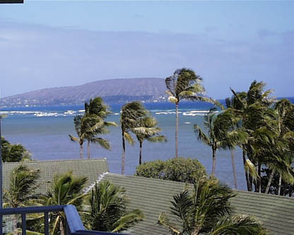
"The view of Koko Head from our room at the Kahala Mandarin Oriental in Honolulu."
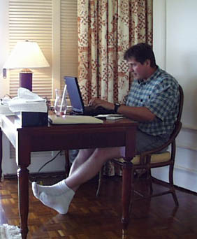
"John typing a posting for the web site in Honolulu."Tomorrow we’re off to Christmas Island, Kiribati, and a night at the Captain Cook Hotel. From there, we’re probably heading to Fiji, possibly via a stop in Samoa, and then on to Australia and parts West.
 |
Satellite data provided by The Living Earth ® Inc./Earth Imaging © 1996, All Rights Reserved.
Click near each end of the red arrows for progressive reports
Click the following
Legs for Progressive Reports
|
Current position of
Ponceby.
Satellite
data provided by The Living Earth
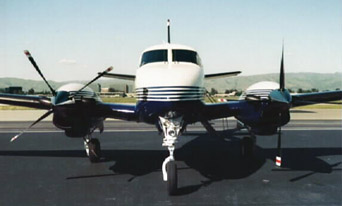
The E90 King Air "Ponceby" |
HOME | The Pilots | The Plane | Pre-Flight | Itinerary | Latest | Flight Following | Discussion | Newsletter | Email
Join the Ponceby Newsletter Email list for news about the next flight
Website Sponsored by
Webbnet - Internet Solutions