 |
|
HOME | The Pilots | The
Plane | Pre-Flight | Itinerary | Latest | Flight
Following
| Discussion | Newsletter | Email
![]() Join
the Ponceby Newsletter Email list for
news about the next flight
Join
the Ponceby Newsletter Email list for
news about the next flight
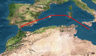
Gibraltar to Cascais Malta to Gibraltar Israel to Malta
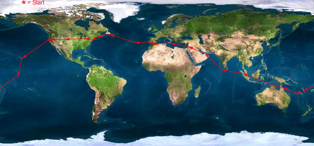
Live Satelite Image
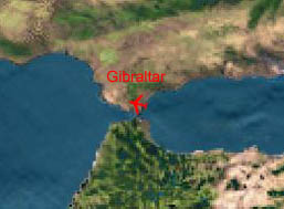
Satellite data provided by The Living Earth ® Inc./Earth Imaging © 1996, All Rights Reserved. LEG 14: LMML-LXGB (Malta-Gibraltar) 15 Aug 98 6.0 hours
On arrival in Malta, the handling agent is nowhere to be found. The airport officials take care of the formalities very efficiently though, and we were shortly on our way to the hotel. Turns out the agent was relayed an arrival time for us based on Zulu instead of Local. He called later and apologized profusely for his absence, and did yeoman’s work the following morning, delivering 3 large trays of turkey sandwiches for lunch, the first catering which had arrived as requested in quite some time.
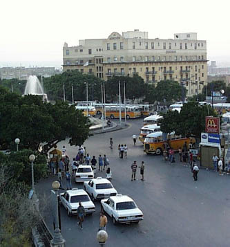
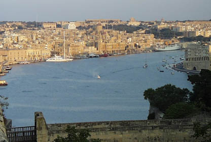
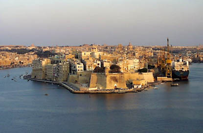
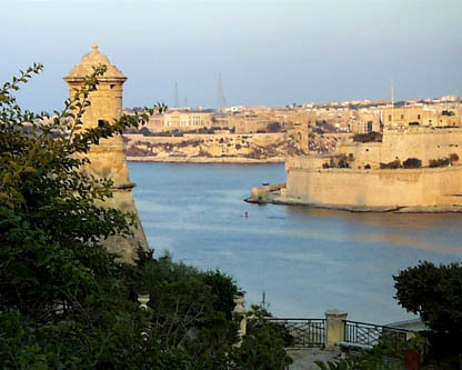
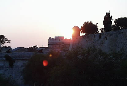
The hotel is placed at the entrance to the old, walled city of Valetta, home of the famed knights of Malta. There is time for a short walk, and some snapshots follow.
"The Phoenicia, now a Meridian Hotel"
"A view from Fortress Malta"
"Medieval stone works alongside modern shipping cranes"
"Almost a Postcard"
"Time for dinner"
Our plan this morning is to fly from Malta to Gibraltar, and then on to Lisbon, Portugal for the 1998 Expo, the last world’s fair of the Millennium. Gibraltar is a British RAF Facility and requires prior permission to land. Lisbon is public, but further investigation shows that it is closed by NOTAM to general aviation from 6 in the morning until 10 at night due to parking problems associated with the Expo.
A late arrival in Lisbon seems fine, but a 5:30 departure a few days later seems uncivilized. We have a long, midnight phone call with Universal Flight Planning to look for alternate solutions. A request for exception to the NOTAM can be made with the Lisbon Airport Authorities in the morning, but we will be airborne when their response arrives. Plan B is to land at the Cascais airport, a small satellite to the main Lisbon facility, but not an Airport of Entry (AOE). Cascais has no instrument approaches so good weather is required.
We decide to launch for Gibraltar, and to pick up the answer from Lisbon on arrival. More later.
The most direct route from Malta to Gibraltar is via Tunis and Algiers along the Barbary Coast of Africa. An overflight of Algeria requires 3 days to arrange, and we are not planning that far ahead at this point, so we choose a more northerly route. The plan is to overfly the islands of Sardinia, Palma de Mallorca, and Ibiza, then Spain’s coastal Sierra Nevada mountains before landing at Gibraltar.
As usual, the departure is rushed. Malta tower issues the clearance minutes before departure and issues the SID (departure instructions) when we are lined up in position for takeoff. We scramble to get the GOZO 3 Departure (the SID) into the GPS and take off over cliffs that drop 100 feet to the sea.
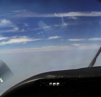
The weather has settled into a pattern reminiscent of California in summer. High pressure over the Atlantic called the ‘Azores High’ (analogous to the ‘Pacific High’ in California) produces warm, hazy, weather in the Med with a pronounced temperature inversion that we see as a jump in OAT in the climb and outside, as a sharp cap on the haze.
"The top of the haze layer approaching the Carbonara VOR, Sardinia, Italy"
Our latitude now is comparable to that at home in California, roughly 35 degrees North, and consequently the winds have become westerly. We start this leg with a 20 knot headwind that increases to more than 40 knots by Gibraltar. Somehow, we don’t mind much. We have previously done most long trips in single engine airplanes, and a strong headwind hurts much more in a Bonanza than in the King Air. Besides, there’s a lot to see.
I
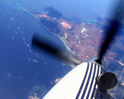
"The Island of Ibiza, this photo was shot with the airplane steeply banked"
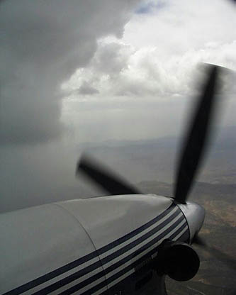
"A storm cloud over Spain’s Sierra Nevada, these clouds were icy."
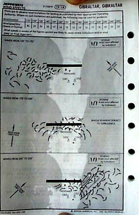
The approach at Gibraltar is a real treat. A layer of stratus clouds covers the area with local ceilings of about 1500 feet (about the height of the rock). Turbulence can be so strong here that Jeppessen issues a chart that maps updrafts and downdrafts that can be expected with varying wind conditions.
"Turbulence chart for Gibraltar"
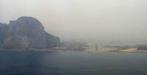
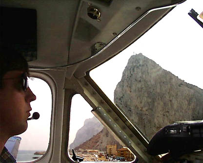
The only instrument approaches available are via surveillance radar. A very good, RAF controller ("Gibraltar Talkdown") gives us headings to fly and target altitudes along the approach that result in a perfect lineup for runway 27 (of course we backed up with GPS). Our first sight of ground was the enormous, hazy outline of the rock itself.
"On Final, runway 27 at Gibraltar"
"Very Short Final at Gibraltar"
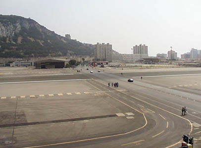
The runway at Gibraltar completely spans the narrow peninsula which leads from Spain to the Rock, so all traffic from the city of Gibraltar (population 30,000) to Spain must cross the runway! This is the only major airport in the world with a bisecting highway. Midway through the landing roll, we see cars, bikes, and pedestrians lined up by the hundreds, waiting for the completion of our landing and back-taxi so that they can cross the runway.
"The highway across the runway at Gibraltar"
After parking, we are greeted with courteous, efficient handling and some bad news. Lisbon has denied our request. We must go to Cascais. It seems that exceptions can only be granted to aircraft with weights greater than 10 metric tons; we are about 5. Ultimately, this turns out to be a blessing. More later.
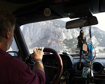
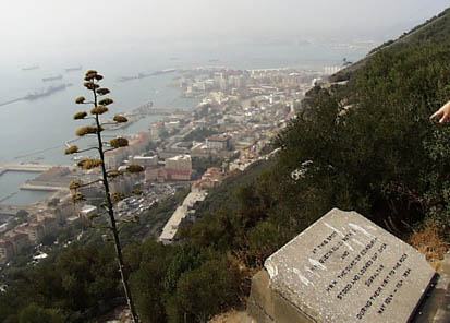
We hire a taxi for a quick round trip to the top of the rock. Clive, the driver, delivers a non-stop monologue of local, natural, and military history. The caves cut into the limestone at regular intervals were for siege guns that, according to Clive, could loft a shell more than 20 miles into Africa! The rock is lined with more miles of passages and walkways than there are miles of roadway on the island.
"Clive, host of the whirlwind Gibraltar tour. Note the gun caves cut into rock"
"A view from the Rock, an American Los Angeles Class Submarine is in port below"
The tour is rushed. We have about 3 hours to accomplish fueling, customs, security, phone calls to Universal in Houston, tower visits, met office visits, currency exchange, and the tour. Somehow, we’re on time. Now, just one more flight today.
 |
Satellite data provided by The Living Earth ® Inc./Earth Imaging © 1996, All Rights Reserved.
Click near each end of the red arrows for progressive reports
Click the following
Legs for Progressive Reports
|
Current position of
Ponceby.
Satellite
data provided by The Living Earth
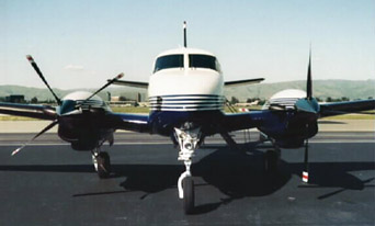
The E90 King Air "Ponceby" |
HOME | The Pilots | The Plane | Pre-Flight | Itinerary | Latest | Flight Following | Discussion | Newsletter | Email
Join the Ponceby Newsletter Email list for news about the next flight
Website Sponsored by
Webbnet - Internet Solutions