 |
|
HOME | The Pilots | The
Plane | Pre-Flight | Itinerary | Latest | Flight
Following
| Discussion | Newsletter | Email
![]() Join
the Ponceby Newsletter Email list for
news about the next flight
Join
the Ponceby Newsletter Email list for
news about the next flight
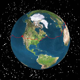
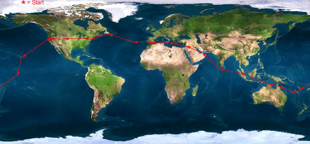
St. John to Maine Santa Maria to St. John's Cascais to Santa Maria
Live Satelite Image
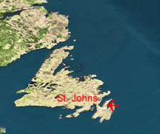
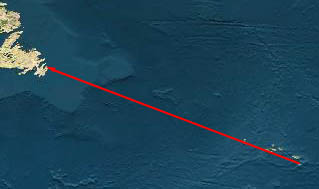
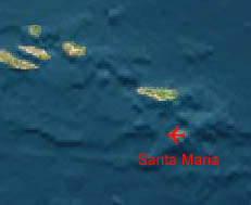
Satellite data provided by The Living Earth ® Inc./Earth Imaging © 1996, All Rights Reserved. Leg 17 LPAZ-CYYT Santa Maria, the Azores - St. John’s, Newfoundland 19 Aug 1998 6.9 hours
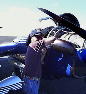
This will be our last oceanic flight, and we’re looking forward to the end of ferry fuel and HF hassle. Fueling goes smoothly, but the left engine won’t start. We get indication of ignition, but no combustion in the engine. We call maintenance, but before they can arrive, the amateurs (us) have both glow plugs changed out with replacements from our spares kit. The engine fires up, and the total delay is less than an hour. On one front, the delay is helpful. We have no catering this morning, and the local restaurant is now able to make up ham and cheese sandwiches. Serendip.
"Doug changing glow plugs"
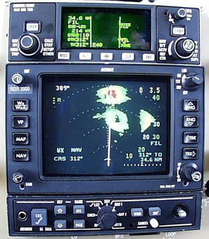
The flight itself goes very smoothly. The Azores are extended over hundreds of miles, and each is capped in cloud. We see each island first on radar, then visually as little bits of land pop into view through the dense clouds.
"The red blotch on the radar screen is Horta, one of the Azores Islands."
"The island itself from a vantage point nearer in"
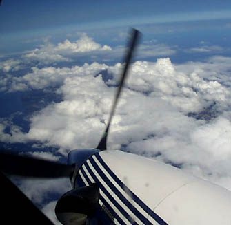
After passing the island of Flores, we have a thousand miles of ocean until reaching the coast of Newfoundland. The Atlantic is very calm with scattered cumulus clouds far below. We’re enjoying a light tailwind. Peaceful traveling.
By contrast, the radios are howling with activity. We hear Delta, United, British Airways, Reach (Air Force Cargo),and bizjets, and everyone is having trouble with the HF. One controller suggests that sunspot activity is high. In any case, many flights are attempting to relay their position reports on VHF to flights which have managed to establish HF communications with ATC. Others are just shooting the breeze. We hear conversations on families, company procedures, new telescopes, watering holes in Orlando, and the Moons of Jupiter. A real beehive. For once, our HF radio seems to work reasonably well, and we talk to Santa Maria, New York Radio, and Gander Radio before landing at St. John’s.
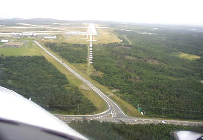
The weather at St. John’s is lousy with a cold front sitting on top of the airport. We fly the ILS and land in light rain.
"Short Final 29 at CYYT, The ceiling is 800 feet"
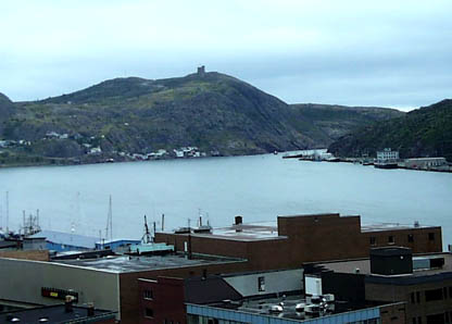
Established in 1497, Saint John’s, Newfoundland claims to be the oldest city in North America. As an interesting parallel, our departure island, Santa Maria was also first sited in 1497. The narrows, a deep channel which opens into the Atlantic, was Charles Lindbergh’s last visual checkpoint before reaching the Irish Coast.
"Another hotel view, this is the narrows that Lindbergh used as his checkpoint. The castle on the hill is the site of Marconi’s first transatlantic radio transmission."
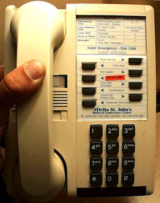
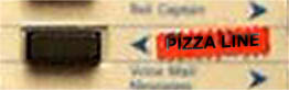
"Back in civilization, pizza at the touch of a button"
 |
Satellite data provided by The Living Earth ® Inc./Earth Imaging © 1996, All Rights Reserved.
Click near each end of the red arrows for progressive reports
Click the following
Legs for Progressive Reports
|
Current position of
Ponceby.
Satellite
data provided by The Living Earth
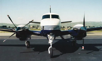
The E90 King Air "Ponceby" |
HOME | The Pilots | The Plane | Pre-Flight | Itinerary | Latest | Flight Following | Discussion | Newsletter | Email
Join the Ponceby Newsletter Email list for news about the next flight
Website Sponsored by
Webbnet - Internet Solutions