 |
|
HOME | The Pilots | The
Plane | Pre-Flight | Itinerary | Latest | Flight
Following
| Discussion | Newsletter | Email
![]() Join
the Ponceby Newsletter Email list for
news about the next flight
Join
the Ponceby Newsletter Email list for
news about the next flight
Danbury to Meadville Maine to Danbury St. John's to Maine
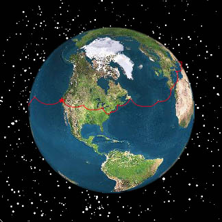
Live Satelite Image
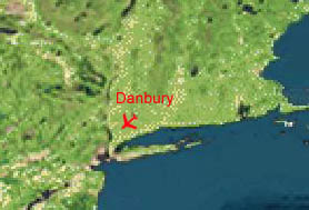
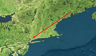
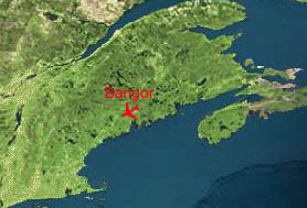
Satellite data provided by The Living Earth ® Inc./Earth Imaging © 1996, All Rights Reserved. LEG 19: Bangor, Maine (KBGR) to Danbury, Connecticut(KDXR), 20 August 1998 1.9 hours
We had again filed airways down to Danbury, with about 15 waypoints most less than 50 miles apart. But there was to be no direct routing in the busy Northeast corridor of the US. In fact, this time Boston Center came on and said, "well, there are a couple of ways you can get to Danbury, but the one you filed is not one of them." He gave us two alternatives, and told us to take our time looking them over and to get back to him with our decision.
This is part of the "Preferred Routes" system, which we read a lot about but almost never see flying in the West. We took the least ugly option, which took us out to the coast, over Madison and Bridgeport to the Carmel VOR, before turning back northeast to Danbury.
Flying in the US is so much easier than abroad, and we don’t really appreciate how lucky we are until we’ve been gone and returned. Flight plans aren’t necessary, and when you use them you can just phone them in instead of having to submit hard copy either in person or by fax. We don’t have to call to request engine start; just fire up and go. Still, it’s hard to break our new habit of calling ourselves "November Eight-Niner-Eight Whiskey Whiskey" (a.k.a., "November Double Whiskey"), and to go back to the US standard of "King Air Eight-Niner-Eight Whiskey-Whiskey," a.k.a. "Eight-Whiskey-Whiskey." And it was kind of funny, after dealing with so many accents abroad, to come back to heavy Boston and New York accents on ATC.
"Double-Whiskey parked at Danbury Airport, Connecticut."
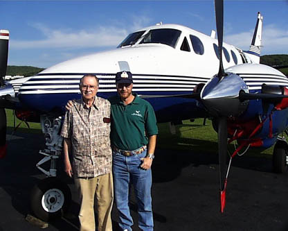
The flight was busy, with no ATC short-cuts, but uneventful. We were kept at 3,000 feet until over the airport. The wind was light and variable, so we chose to land on the 4,400 foot Runway 08 instead of the shorter (3,100 feet) active Runway 35. As we taxied to parking at the Business Aircraft Center, Doug’s dad, Barry, was there to meet us.
We stayed at the local Danbury Hilton, and Doug’s sister, Claudia, and her husband, Guy, drove down from their home in Litchfield, Connecticut, to join us all for dinner. We had a good Italian meal at Ciao’s and caught up with each other over a pleasant evening. The next morning, Barry picked us up at the hotel and drove us back to the airport to see us off. Then we fired up and set off for Meadville, Pennsylvania, to visit John’s family.
"Doug and his father, Barry, at the Danbury Airport."
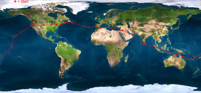 |
Satellite data provided by The Living Earth ® Inc./Earth Imaging © 1996, All Rights Reserved.
Click near each end of the red arrows for progressive reports
Click the following
Legs for Progressive Reports
|
Current position of
Ponceby.
Satellite
data provided by The Living Earth
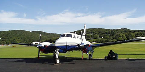
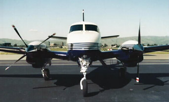
The E90 King Air "Ponceby" |
HOME | The Pilots | The Plane | Pre-Flight | Itinerary | Latest | Flight Following | Discussion | Newsletter | Email
Join the Ponceby Newsletter Email list for news about the next flight
Website Sponsored by
Webbnet - Internet Solutions