 |
|
HOME | The Pilots | The
Plane | Pre-Flight | Itinerary | Latest | Flight
Following
| Discussion | Newsletter | Email
![]() Join
the Ponceby Newsletter Email list for
news about the next flight
Join
the Ponceby Newsletter Email list for
news about the next flight
Darwin to Singapore Cairns to Darwin Vanuatu to Cairns
 |
 |
 |
 Live Satelite Image Live Satelite Image |
Satellite data provided by The Living Earth ® Inc./Earth Imaging © 1996, All Rights Reserved. | |
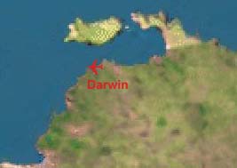
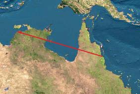
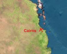
Leg 7: YBCS-YPDN (Cairns to Darwin, Australia) 31 July 1998 4.6 hours
The vast and desolate Pacific gives way to the vast and desolate Australian continent. Australia is so sparsely settled that we must use the HF radio occasionally, even overland. In the outback, ATC is with Adelaide Center, over a thousand miles to the south. A light headwind gives way to strong tailwinds as we again approach the equator, from the south this time. We have carried a little ferry fuel, 400 liters only, in the event that the tailwinds don’t materialize. As usual, we land at Darwin with an extravagant reserve.
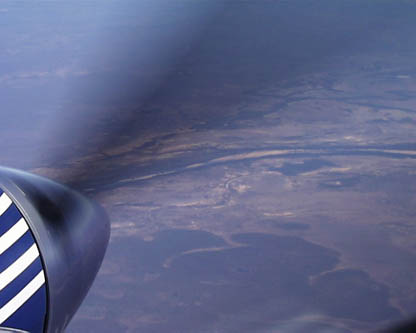
"awfully bleak terrain West of Cairns, Australia"
A few notes on navigation:
In general, we fly published routes wherever possible. There are several reasons for this. First, many countries, Egypt for example, only allow flight on airways. Overflight and landing permits for these nations may only be obtained after specifying your airway entry and exit points. Published routes give predetermined obstacle clearance altitudes and often allow good VHF communications. Finally, airways usually mean easier radio work. If we are traveling along J61 from Cairns to Darwin, it's much easier to report your position as "GULOP" intersection than to say "November 898WW was one five four niner south one four one five five east", the geographical coordinates of GULOP.
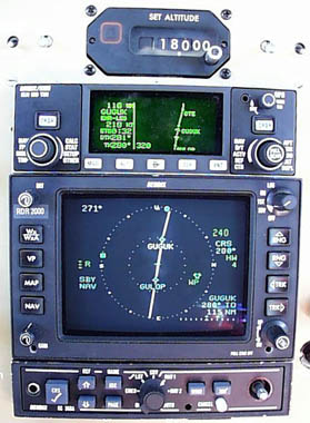
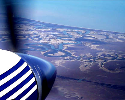
"enroute from GULOP to GUGUK, over Australia’s Cape York peninsula"
The photo above shows our normal navigation setup (apologies for the grainy picture, this is the best macro that we could get with the digital camera).
We enter the flight planned route into the KLN-90B (the box on top). The GC-360A graphics adapter (the box on the bottom) allows the waypoints of this route to be displayed on the radar display (the box in the middle). Here we are midway between GULOP and GUGUK, two waypoints along J61. GULOP is over the Cape York peninsula and GUGUK is over the Gulf of Carpentaria. The radar shows our heading to be 271 degrees vs. A course of 281 degrees. The ten degree crab angle is obvious from the tilt of the courseline. The wind direction is indicated by a green square on the left side of the display and the headwind component is shown in the text to the right as 4 knots. The radar itself is in a standby mode for clarity.
"enroute from GULOP to GUGUK, a view out the window"
Of course, all the information on the displays above is GPS based. We normally tune the associated VOR and NDB stations that define a route and display their output on the RMIs (which can NOT point to the GPS waypoints). However, our real backup is a second GPS built into the panel into which we input a duplicate flight plan and display its output on the copilots nav display. This way at each waypoint, we can compare the two displays to provide a check against (pilot) input errors.
As an aside, it’s interesting to note that many of the VOR and NDB stations along our routes are "on request only" (for a small fee of course).
 |
Satellite data provided by The Living Earth ® Inc./Earth Imaging © 1996, All Rights Reserved.
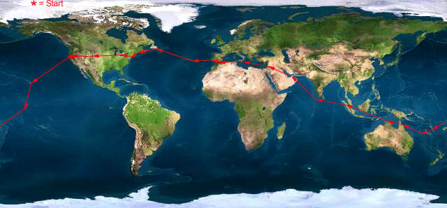
Click near each end of the red arrows for progressive reports
Click the following
Legs for Progressive Reports
|
Current position of
Ponceby.
Satellite
data provided by The Living Earth
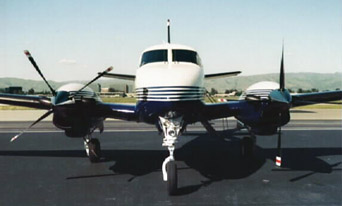
The E90 King Air "Ponceby" |
HOME | The Pilots | The Plane | Pre-Flight | Itinerary | Latest | Flight Following | Discussion | Newsletter | Email
Join the Ponceby Newsletter Email list for news about the next flight
Website Sponsored by
Webbnet - Internet Solutions