 |
does
|
HOME | The Pilots | The
Plane | Pre-Flight | Itinerary | Latest | Flight
Following
| Discussion | Newsletter | Email
![]() Join
the Ponceby Newsletter Email list for
news about the next flight
Join
the Ponceby Newsletter Email list for
news about the next flight
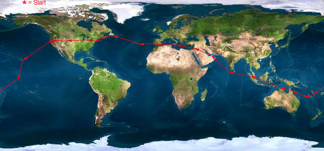
Cairns to Darwin Vanuatu to Cairns Fiji to Vanuatu
 |
 |
 |
 Live Satelite Image Live Satelite Image |
Satellite data provided by The Living Earth ® Inc./Earth Imaging © 1996, All Rights Reserved. | |
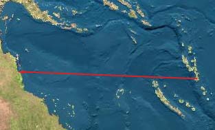
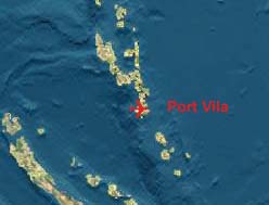
Leg 6: NVVV-YBCS, Port Vila, Vanuatu to Cairns, Australia, 30 July 98, 7.0 hours
What a relief to be finished with the dateline! See if you can follow the itinerary to date. We had quite a bit of difficulty getting and keeping this straight.
We departed Honolulu on July 23 at 10 AM to arrive Christmas Island, after a 6 hour flight on July 24. The next day, July 25, we depart Christmas Island westbound for Apia, Western Samoa. After another 6 hour flight, we arrive in Apia on July 24 again! After a night’s rest, we launch on July 25 to land 3 hours later at Nadi, Fiji on July 26! How is this all possible?
The tricky element is local time on Christmas Island. Even though their local longitude is 157 degrees West, the islanders have declared themselves to be West of the dateline in order to be the very first nation to celebrate the new millennium (tourism dollars, etc.). So a flight south from Hawaii gains a day. Then flying west to Apia (Longitude about 172 degrees) is equivalent to crossing the dateline eastbound since the locals haven’t changed their time reference in Western Samoa. This flight arrives W. Samoa a day before it leaves. Finally, the trip to Fiji involves a "normal" westbound dateline crossing and gains a day.
Obviously, lots of room for confusion. It finally caught up with us in Fiji where we arrived on July 26 with a landing permit issued for use on July 25. As luck would have it, this occurred on a stop in which there was very little turnaround time available as we had to get to a satellite island airport by sunset. Somehow we made it.
Today’s flight is 1300 NM from Vanuatu to Australia, a walk in the park except that the southern jet has moved quite a bit north with 60 knot headwinds forecast at our normal cruising altitudes. At Flight Level 180, we are looking at a 10 hour flight. Yuk. Fortunately, we miss our normal morning wx briefing (which has only high level wind data), and receive an alternate briefing that shows normal trade winds at 10,000 feet and below. We file for 10,000 and go. Fuel consumption is quite high down low, but we have a substantial net gain with the wind advantage. The flight works out to a little less than 7 hours, and we have a very pleasant sea level cabin for the first time on the trip. Serendip!
To date our flight has been almost purely in visual conditions. Today, The progs show a weak front across our path running from the SE to the NW for almost a thousand miles. After 3 hours, the first clouds come into sight. The rain is so light, it’s barely visible on radar. The airplane is so dirty from days parked outside that the water sheeting from the wings is a muddy brown. The Pacific below changes from calm to frequent white caps as we cross the front. Still 4 hours until landfall.
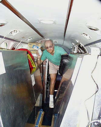
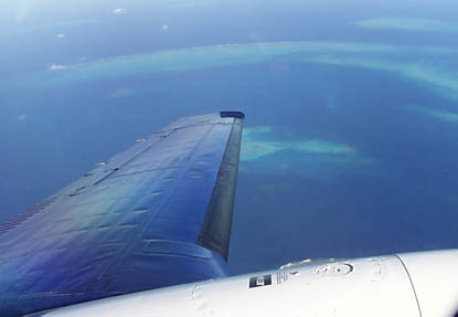
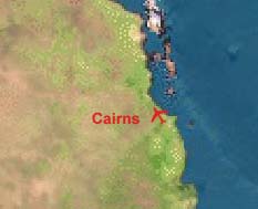
"Doug spraying the cabin with the highly prized and sought after, approved top-of-descent insecticide"Outside of having to spray the cabin with an insecticide at the top of our descent (Australian requirements), the arrival at Cairns is a treat. A solid undercast clears 150 NM short of the Australian coast providing a sweeping view of the Great Barrier Reef. Cairns has radar and we’re assigned a transponder code, the first since Hawaii (although the reply light has flashed almost continuously over the Pacific where the normal squawk is 2000). Cairns is sunny and warm, neat and clean. A welcome stop.
"Australia’s Great Barrier Reef, the Pacific is behind us now."
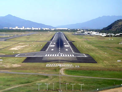
"Final Runway 15 at Cairns, Australia"
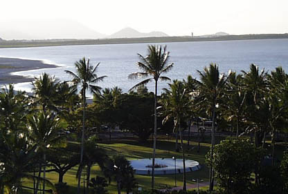
"The view from the Cairns Hilton, airport air traffic control tower in the background"
"I hear there’s good pasta here someplace"
 |
Satellite data provided by The Living Earth ® Inc./Earth Imaging © 1996, All Rights Reserved.
Click near each end of the red arrows for progressive reports
Click the following
Legs for Progressive Reports
|
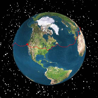
Current position of
Ponceby.
Satellite
data provided by The Living Earth
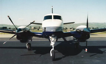
The E90 King Air "Ponceby" |
HOME | The Pilots | The Plane | Pre-Flight | Itinerary | Latest | Flight Following | Discussion | Newsletter | Email
Join the Ponceby Newsletter Email list for news about the next flight
Website Sponsored by
Webbnet - Internet Solutions