 |
|
HOME | The Pilots | The
Plane | Pre-Flight | Itinerary | Latest | Flight
Following
| Discussion | Newsletter | Email
![]() Join
the Ponceby Newsletter Email list for
news about the next flight
Join
the Ponceby Newsletter Email list for
news about the next flight
California to Hawaii The Departure
Hawaii Flight Planning
At 2100 NM, San Jose-Honolulu is the first and the longest leg of the entire trip. Established routes exist for this much-traveled corridor. Our route begins with the intersection named CLUKK and ends appropriately at CLUTZ. A random route could be filed, but by flying underneath the airliners, you have an alternate communications relay on the VHF (all traffic monitors 121.5). Also, if you ditch, you’ve got a good com link to search and rescue.
The pure jets, high overhead, leave contrails that a generation of ferry pilots have used to cross check their ded reckoning. We will be flying against the traffic flow (the standard routes are one way) with the hope of catching sight of these contrails on the horizon. Of course, our KLN 90B GPS can hold the route centerline as closely as jet nav gear.
A typical KSJC-PHNL day begins with headwind and ends with tailwind. This can be unsettling since a few hours out, your fuel computer may show that you are short of the fuel required to reach destination! Indeed a combination of early headwinds and the high cruise fuel burn associated with heavy initial aircraft weight may cause the aircraft to consume more than half its fuel before the midpoint is reached. Stout hearts will prevail.
Obviously a detailed navigation log must be constructed before the flight, and a check must be made at each waypoint of the actual winds encountered and groundspeed achieved. In addition, an ‘equal time point’ is computed to determine when less time is required to continue to Honolulu than to return to San Jose. This must be computed assuming both engines are running and again considering engine failure (single-engine flight requires a descent to less fuel efficient altitudes). Finally, a ‘point of safe return’ should be determined. This is the last point where one could turn and come home to San Jose with a suitable reserve. For us it’s about 1300 NM.
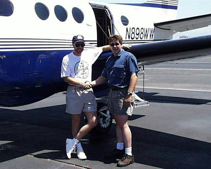
The Departure, the plane running at the San Jose Jet Center. 7/21/98
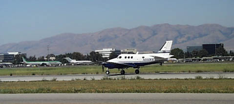
Ponceby on the roll for take-off, the launch of the trip! 7/21/98
"Our next report will come to you from Honolulu.
Tailwinds and aloha, --Doug and John"
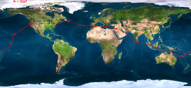 |
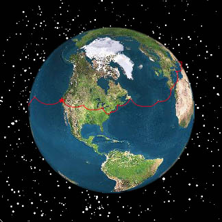
Satellite data provided by The Living Earth ® Inc./Earth Imaging © 1996, All Rights Reserved.
Click near each end of the red arrows for progressive reports
Click the following
Legs for Progressive Reports
|
Current position of
Ponceby.
Satellite
data provided by The Living Earth
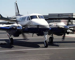
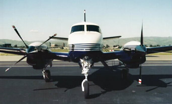
The E90 King Air "Ponceby" |
HOME | The Pilots | The Plane | Pre-Flight | Itinerary | Latest | Flight Following | Discussion | Newsletter | Email
Join the Ponceby Newsletter Email list for news about the next flight
Website Sponsored by
Webbnet - Internet Solutions