 |
|
HOME | The Pilots | The
Plane | Pre-Flight | Itinerary | Latest | Flight
Following
| Discussion | Newsletter | Email
![]() Join
the Ponceby Newsletter Email list for
news about the next flight
Join
the Ponceby Newsletter Email list for
news about the next flight
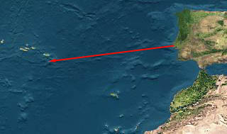
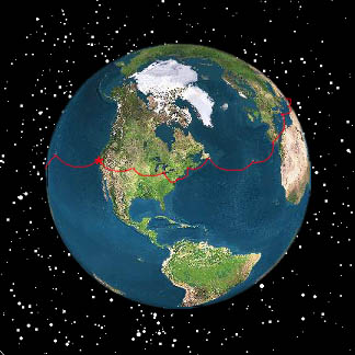
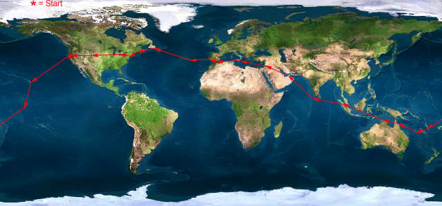
Santa Maria to St. John Cascais to Santa Maria Gibraltar to Cascais
Live Satelite Image
Satellite data provided by The Living Earth ® Inc./Earth Imaging © 1996, All Rights Reserved.
Leg 16 LPCS-LPAZ Cascais-Santa Maria, The Azores 18 Aug 98 4.0 hours
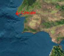
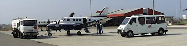
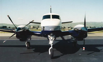
"Servicing Double Whiskey prior to departure from Cascais, Portugal"
Our stay in Portugal is so pleasant that on departure day we scarcely notice that the weather briefing does not show up and that the handling agent is nowhere to be found. The normal airport personnel are quite capable though and we are shortly fueled, filed and ready to go.
We have been trying to get the tires serviced since Singapore with no success. Here, we ask and it’s accomplished in about 10 minutes. In Singapore, we would have had to wait for an hour for air and in Gibraltar, the agent said that any maintenance (air for the tires) would require coordination with British Airways at a minimum cost of $500 USD. It’s nice to be back in small airports.
We strap in and call for clearance. Tower says that there is a problem with the flight plan, and to expect delay. We call back in 15 minutes and they say we must contact airport operations, so we leave the aircraft and call ops. Seems that a computer did not recoqnize our aircraft ID. We had been using "BE90"since the trip's beginning, but this computer wanted "BE9T". So we do this and wait for the wheels to turn. Thirty minutes later we are underway.
It seems strange to depart on an oceanic flight without fuel in the ferry tanks, but it’s only 786 Nautical Miles to the Azores and internal fuel is good for 1500. Other than poor HF radio performance, we have a very simple flight.
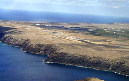
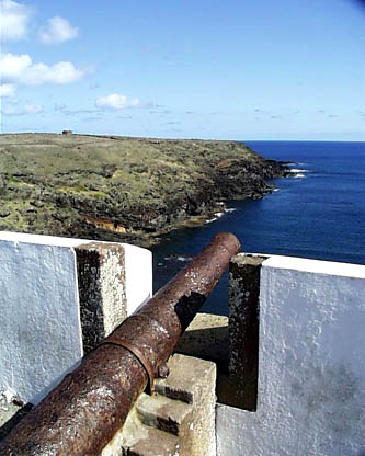
The Azores are volcanic, but at 36 degrees North, we are in temperate latitudes so we see no coral reefs. The islands are largely covered in cloud, but the airport is situated on a lava apron virtually on the coast so a visual downwind, just off shore, works fine for the arrival.
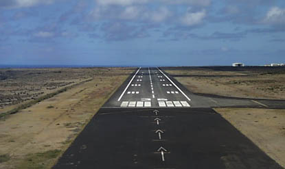
"On the left base for LPAZ"
"Final LPAZ"
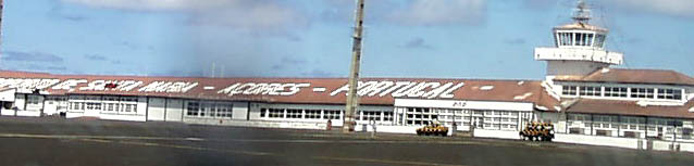
"The taxi to the ramp. This roofline has been a welcome site to ferry pilots for many years"
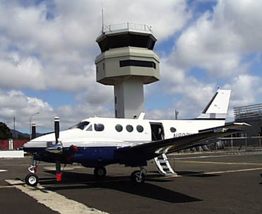
"Double Whiskey and the new tower"
Since technically we’ve not left Portugal yet, we have no customs and immigration chores to do. Handling on the ground is excellent, and we are at the hotel in less than 30 minutes. We ask for transport at 0930 the next morning and for once, we don’t have to worry about time conversions as locals in the Azores observe UTC in periods of daylight savings. Little pleasures.
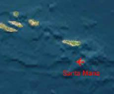
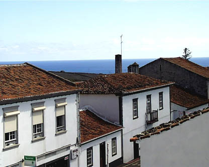
Santa Maria itself is all red roofs and white buildings. Quite pretty.
"Santa Maria, The view from the hotel"
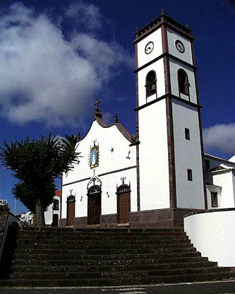
"Santa Maria, the Azores"
 |
Satellite data provided by The Living Earth ® Inc./Earth Imaging © 1996, All Rights Reserved.
Click near each end of the red arrows for progressive reports
Click the following
Legs for Progressive Reports
|
Current position of
Ponceby.
Satellite
data provided by The Living Earth
The E90 King Air "Ponceby" |
HOME | The Pilots | The Plane | Pre-Flight | Itinerary | Latest | Flight Following | Discussion | Newsletter | Email
Join the Ponceby Newsletter Email list for news about the next flight
Website Sponsored by
Webbnet - Internet Solutions