 |
|
HOME | The Pilots | The
Plane | Pre-Flight | Itinerary | Latest | Flight
Following
| Discussion | Newsletter | Email
![]() Join
the Ponceby Newsletter Email list for
news about the next flight
Join
the Ponceby Newsletter Email list for
news about the next flight
Epilogue Boulder to San Jose Meadville to Boulder
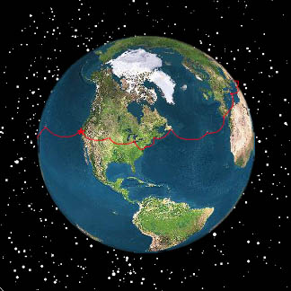
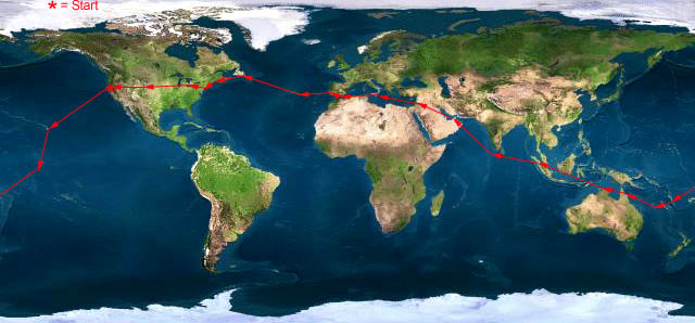
Live Satelite Image
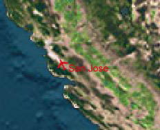
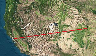
Satellite data provided by The Living Earth ® Inc./Earth Imaging © 1996, All Rights Reserved. LEG 22: KBJC-KSJC Boulder (Jeffco) - San Jose, CA 23 Aug 98 5.0 hours
This is the last leg of the trip, closing the circle. It’s short and easy, again on wing fuel only, and still with almost a three-hour reserve.
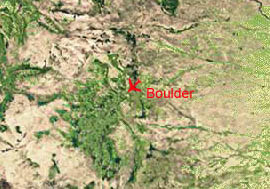
"Waving goodbye to Monte and Claudia at Boulder."
John’s friends Monte and Claudia, with son Raphael, came to the hotel for breakfast, and then to the airport to see us off. We’d spent some time the night before carefully crafting a flight plan using SIDs and STARs (standard instrument departures and arrivals). But, as usual, ATC had other ideas, and we were cleared, "to San Jose Airport via radar vectors Coaldale" VOR, some 600 miles away. As we entered Oakland Center’s airspace near Coaldale, our amended route was "direct Modesto, then via the 216 degree radial to LICKE direct." Some much for STARs!
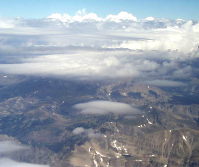
"Climbing out among the clouds on departure from Boulder (Jeffco)."
We took off into a beautiful Colorado morning, where the ATIS was reporting 80 mile visibility, and climbed up through and around some scattered puffy clouds to our cruising altitude of FL200 (20,000 feet). We had beautiful weather the whole trip, culminating in a visual approach to Runway 29 at San Jose. Our Denver Center controller kept wishing everyone a facetious "dandy day" when he handed them off; we wished him a peachy afternoon.
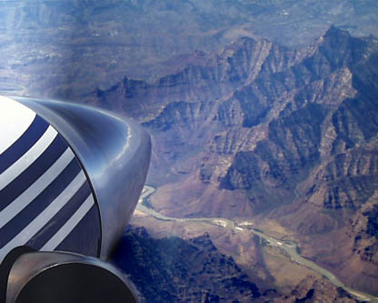
"Typical western scenery."
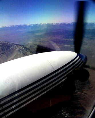
"Seeing the still-snow-capped peaks of the Sierras."
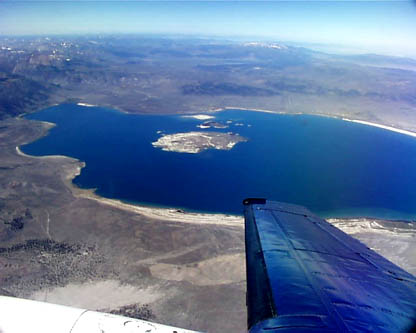
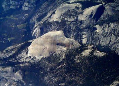
The landscape of the western US is unlike anyplace else, and is intimately familiar to us. As we crossed the Rocky Mountains, it truly felt like we were coming home to our usual stomping grounds. John could probably fly the entire route visually by known landmarks, without need for charts or even compass! We saw snow on the peaks of the Sierras from 200 miles away, and flew right over Mono Lake (where we had flown to see the Hale-Bopp comet a year ago). Then over Yosemite and Half Dome and into the central valley of California. We couldn’t help but feel a growing buzz of excitement as we got closer and closer to home.
"Mono Lake from 20,000 feet—back in sunny California!"
"Yosemite and Half Dome."
As we neared San Jose, we started thinking about wrap-up and follow-up. What does life after this trip hold in store for us? What loose ends do we have to tie up? We realized that we had stopped talking to Universal after Danbury, since it’s so easy to do everything ourselves in the US. But we hadn’t called them to close out the trip. We tried raising them on the HF radio (our first voluntary use of that infernal device), but no joy. We talked about how to get the ferry tanks removed, and where to store them for the next trip, and how nice it will be to see this plane with an interior in it. It will be a pretty sweet travelling machine without a cabin full of fuel. We talked about John’s return to school the next day, and how we were going to get the Yak flying again and liberated from Castle. And we talked of all the people we want to see, and those we want to thank for their help making this trip a success.
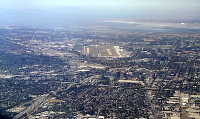
"Back into the Bay Area and San Jose International."
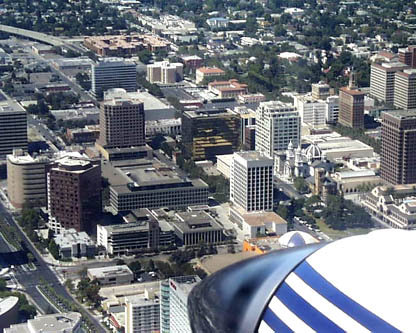
After Modesto, en-route to LICKE intersection, we really felt like we were in our own backyard. We flew over Castle Airport, where the Yak sits waiting for us in Tac Alert 3. Then over Crow’s Landing and the East Bay hills, where we receive vectors, and then instructions to maintain visual separation from a Boeing 737 and to follow him in to land at SJC. We cross the final for the big runway (30L) and line up for a long straight-in approach to Runway 29, passing low over downtown San Jose to a perfect landing.
"Downtown San Jose, as seen on three-mile final."
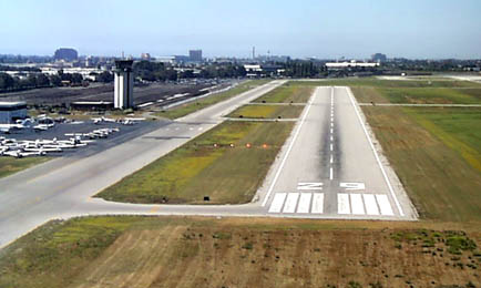
"Our last landing, back home, completing our round-the-world circle at Ponceby’s home base."
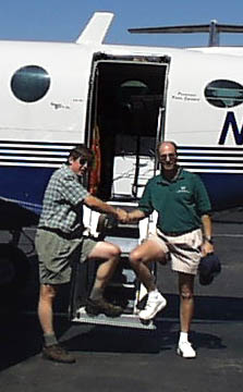
On arrival, we were met by Doug’s Mom (who had been housesitting for him) and by the tireless Ponceby Web Crew, Milt and Brian. We were exhausted, but thrilled to be home and to have successfully completed this long-planned, and often-jeopardized, trip. We returned home with both the plane and ourselves in one piece, and lived to do it again. What a long, strange trip it’s been!
"A successful completion of the journey."
After a congratulatory, documented handshake completing the trip, we unloaded all our junk from the plane into Doug’s car, which miraculously started after sitting a month in the Jet Center parking lot and looked like it had just driven all around the world (Ponceby looked much better!).
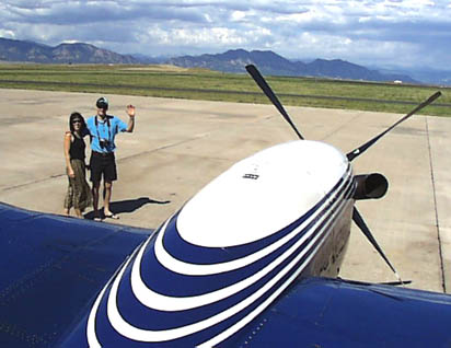
"Ponceby flight and web crew: Doug, Milt, Brian and John."
We were finally able to meet Brian from Webbnet—the driving force who made this Web site a reality—who we knew only from cyberspace prior to this. Brian completed his Private Pilot ticket during our journey, and wore the lucky Ponceby Round-the-World T-shirt on his checkride (congratulations, Brian!). Incredible work doing this great Web site, while finishing his first rating and holding down a day job as well. Our base ops coordinator, Milt, who worked closely with Brian driving site improvement and licensing deals, also came to greet us. Thank you, Brian and Milt, for all your help!
So, what’s next? Well, for now, reinsertion into the so-called "real world" and resumption of our prior lives. After that, who knows? Milt swears that next time John and I will only have to fly, while he and Brian and the rest of an entourage will come along to document everything for the Web site. Minicams embedded in the tail, wings and cockpit; real-time satellite uplinks of Digital Video and telemetry; live audio/video broadcast constantly from the cockpit; interactive chat sessions; virtual reality putting you, there, live in the cockpit. Hmmm….
Meanwhile, we have more pedestrian interests: flying across Alaska and the Aleutian Islands to Siberia and Mongolia to Tibet and Nepal to see Mt. Everest at long last; circling pole-to-pole; maybe just going back to do the Pacific right, including Easter Island and the Galapagos. The world is a very big place, and we haven’t yet touched the stars. Thank you all for your interest and indulgence. More later…meanwhile, so long, and thanks for all the fish. –D&J.
"Ponceby, home at last."
 |
Satellite data provided by The Living Earth ® Inc./Earth Imaging © 1996, All Rights Reserved.
Click near each end of the red arrows for progressive reports
Click the following
Legs for Progressive Reports
|
Current position of
Ponceby.
Satellite
data provided by The Living Earth
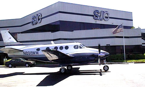
The E90 King Air "Ponceby" |
HOME | The Pilots | The Plane | Pre-Flight | Itinerary | Latest | Flight Following | Discussion | Newsletter | Email
Join the Ponceby Newsletter Email list for news about the next flight
Website Sponsored by
Webbnet - Internet Solutions