 |
|
HOME | The Pilots | The
Plane | Pre-Flight | Itinerary | Latest | Flight
Following
| Discussion | Newsletter | Email
![]() Join
the Ponceby Newsletter Email list for
news about the next flight
Join
the Ponceby Newsletter Email list for
news about the next flight
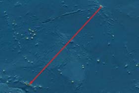
Western Samoa to Fiji Kiribati to Western Samoa Hawaii to Kiribati
Live Satelite Image
Satellite data provided by The Living Earth ® Inc./Earth Imaging © 1996, All Rights Reserved.
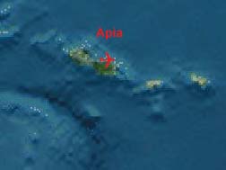
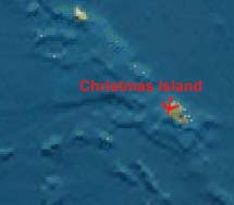
Leg 3: PLCH-NSFA, Christmas Island, Kiribati, to Apia, Western Samoa, 24 July 98, 6.5 hours
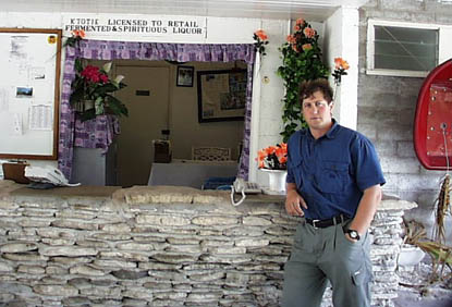
"At the Captain Cook Hotel, we were able to drink "spirituous liquor;" is there any other kind?"
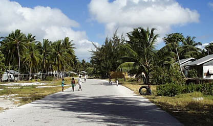
After a pretty good night’s sleep at the Captain Cook Hotel, and a quick breakfast, we headed out for Cassidy Airport on Christmas Island, Kiribati. Very small villages abound, with lots of activity around the main (unpaved) road.
"Scenes from the drive to Cassidy Airport on Christmas Island, Kiribati."
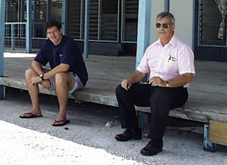
Paul and Tom, the Twin Otter pilots, had just beaten us to the airport, and were doing their fueling first. They had not notified the airport that they would be needing fuel, but the line guy thought he had enough for both of us. We waited while they tried to uplift 1000 gallons, but they had to stop part-way through since they couldn’t reach their center tank, and wait for fuel from the already-filled tanks to transfer by gravity feed. We fueled then, and they had to cancel and wait another day, since they had lost time and their ferry permit was only for VFR day operation, and they no longer had time to reach Honolulu before dark.
"TwOtter pilots Paul and Tom at the Cassidy Airport Arrival Lounge on Christmas Island, after fueling their plane."
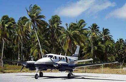
"Ponceby waiting to be fueled at Christmas Island."
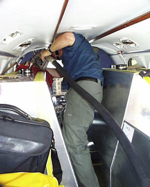
The only way to pay for fuel at Christmas Island is in Australian dollars cash, which I had brought. It cost $1,179 AUD, and I had only a couple hundred more dollars cash to spare. Luckily, it was enough.
"John fueling Ferry Tank #1 at Christmas Island."
We had a nice departure, and flew the 6.7 hour flight to Apia, Western Samoa, uneventfully. We had some HF problems, both because of poor atmospheric conditions, and because our pilot fumbling had inadvertantly switched our transceiver to 10 watts, instead of our usual 100 watts output. Even so, communications was difficult until we switched to Pago Pago Approach on VHF. There had been no catering available (obviously!) at Christmas Island, so food was sorely missed. We subsisted on items in our "Goodies Bag," and that was enough to tide us over.
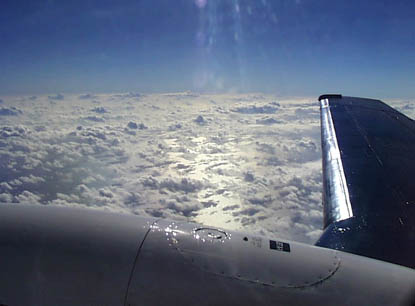
"Somewhere over the South Pacific at FL180, en-route to Samoa."
We did start to pick up headwinds for the first time on the trip, as high as 12 knots, but we were fat on fuel and still landed Apia with a three-hour reserve. We had scattered clouds beneath us most of the flight, and Pago Pago Airport (in American Samoa, right next to our destination in Western Samoa) was reporting 2,000 broken, 4,000 overcast. We set up for the VOR DME ILS DME Rwy 8 approach, but Apia had a clear hole in the clouds over it, so we called the airport in sight and did a quick visual approach, entering the left downwind for Runway 8.
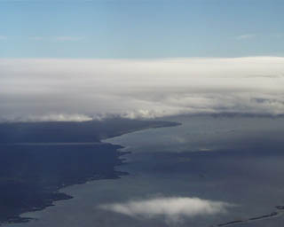
"Approaching the airport at Western Samoa."
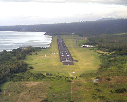
"On short final to Runway 8 at Apia, Samoa."
On the ground, we had handling help from Polynesia Airlines, who helped with customs, fueling, and the morning’s catering order. We then took a taxi into the town of Apia, almost a 45 minutes drive. Beautiful scenes most of the way, with lots of open-air, brightly decorated fales. Everything was immaculately groomed, and exceptionally tidy, showing the great care and pride the Samoans obviously take in their surroundings. Things got a little sloppier as we approached the city of Apia, but the Aggie Grey’s Hotel was very nice. The front, and where we were put, was a modern section like any hotel anywhere, but the rear, original parts were very South Pacific, and in fact was the hotel where Gary Cooper et al stayed while filming the movie of that name.
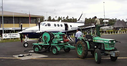
"Re-fueling from AirBP with handlers at Apia Airport in Western Samoa."
We still had no word on any place to stay here or in Fiji for our much-needed beach rest, and went to bed thinking we’d have to just slog through another quick-turn overnight in search of a beach. But a phone call to Qamea Beach Club in Fiji in the morning showed that our luck had changed. While fully booked last week and next week, they are wide open right now, so we are off to Nadi, Fiji, to clear customs, then a quick flight to Taveuni Island, where we’ll be met by car and then transferred by launch to Qamea. I doubt we’ll have Internet access at Qamea, and so cannot predict our next posting. But we’ll be thinking of you all while sipping rum drinks and watching the sunset from the beach, and while snorkeling in the spectacular waters of Fiji.
Doug & John, out.
 |
Satellite data provided by The Living Earth ® Inc./Earth Imaging © 1996, All Rights Reserved.
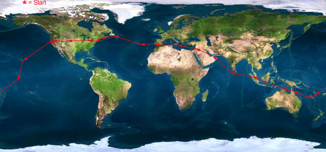
Click near each end of the red arrows for progressive reports
Click the following
Legs for Progressive Reports
|
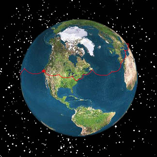
Current position of
Ponceby.
Satellite
data provided by The Living Earth
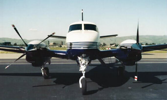
The E90 King Air "Ponceby" |
HOME | The Pilots | The Plane | Pre-Flight | Itinerary | Latest | Flight Following | Discussion | Newsletter | Email
Join the Ponceby Newsletter Email list for news about the next flight
Website Sponsored by
Webbnet - Internet Solutions